
Below are the key methodological features of MapBiomas Suriname for producing land cover and land use maps, as well as maps showing changes between different years.
You can consult the ATBD (Algorithm Theoretical Basis Document), which contains a full description of the methodology and algorithms, via the following link:
MapBiomas Suriname Collectie 1 – ATBD
GENERAL CHARACTERISTICS
All annual land cover and land use maps from MapBiomas Argentina are produced through a pixel-by-pixel classification of Landsat satellite imagery. The entire process is carried out on the Google Earth Engine platform, which offers immense cloud-based processing capacity.

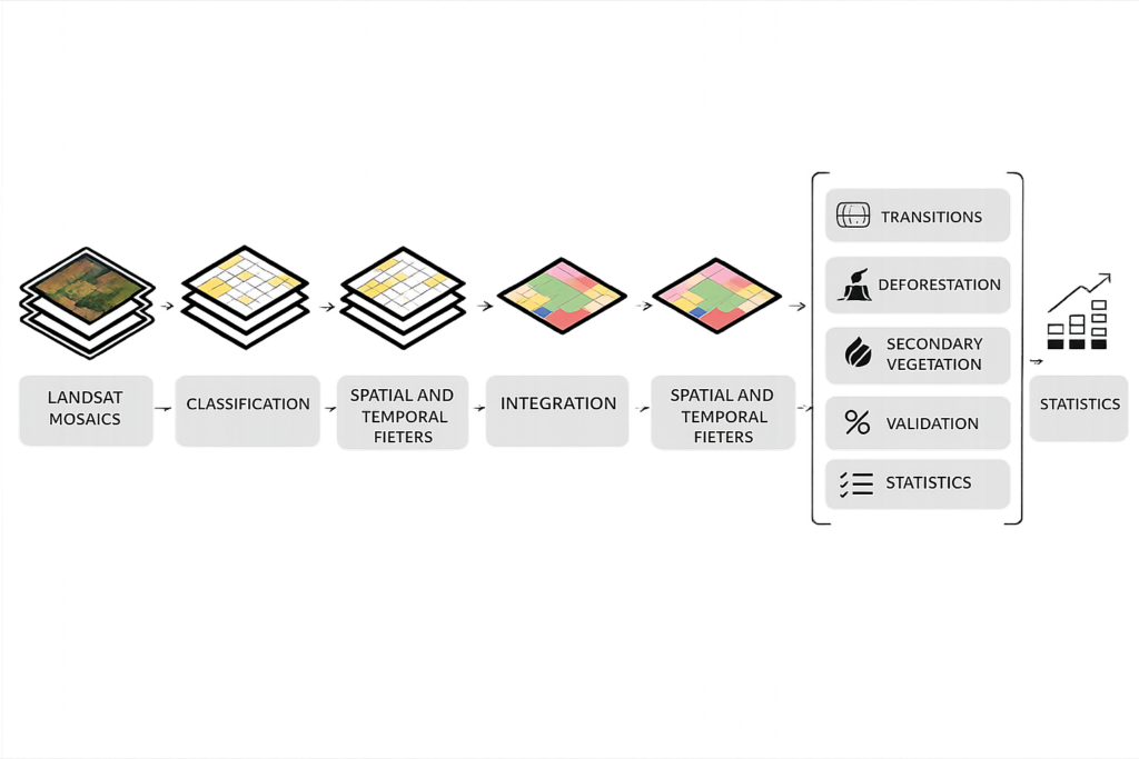
Overview of the methodology
The diagram below illustrates the key phases of the process for generating annual land cover and land use maps—as well as the associated changes—for MapBiomas Suriname.
Get to know it step by step [LINK].